Directory
Bush

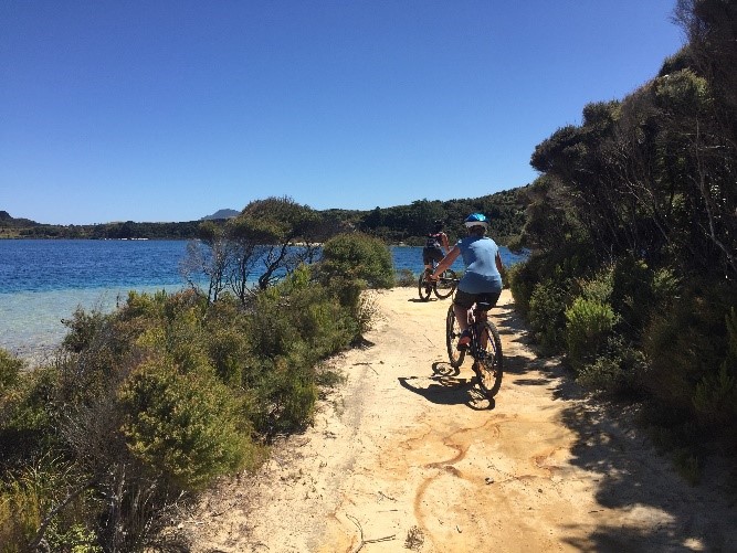
Bike the Kaipara Trust & Trailforks
Click through to the website above to discover the top ten rides in the Kaipara. They are all mountain bike routes except one which may be ridden with road tyres. They are all for experienced cyclists which is why they are 30-80km rides.
We have three easy family rides which can be found on the Kaipara District Council website
Contact person: Nicky Reid | Mobile: 021 103 6277 | Email: nicky@bikethekaipara.co.nz

Footprints Waipoua, Twighlight Encounter
Experience the affinity that Māori have with the forest and the deep spiritual respect they have for these sentinels who have stood silently witnessing the passing of time. Your guide will share thought-provoking information, humorous banter, stories and legends before respectfully greeting the oldest and largest known kauri trees in the world with spine-tingling chants and song.
Be Mesmerised by Te Matua Ngāhere -The Father of the Forest; who at 3,000 years is the oldest giant. Be Enchanted by the largest giant, Tane Mahuta, a national icon.
Witness the day transition to night and by default feel your senses become hauntingly enhanced. Just like these giant kauri trees the memories you seize are timeless treasures.
Phone: 09 405 8207 | Email: admin@footprintswaipoua.co.nz | Address: 334 State Highway 12, Omapere, 0444, Hokianga
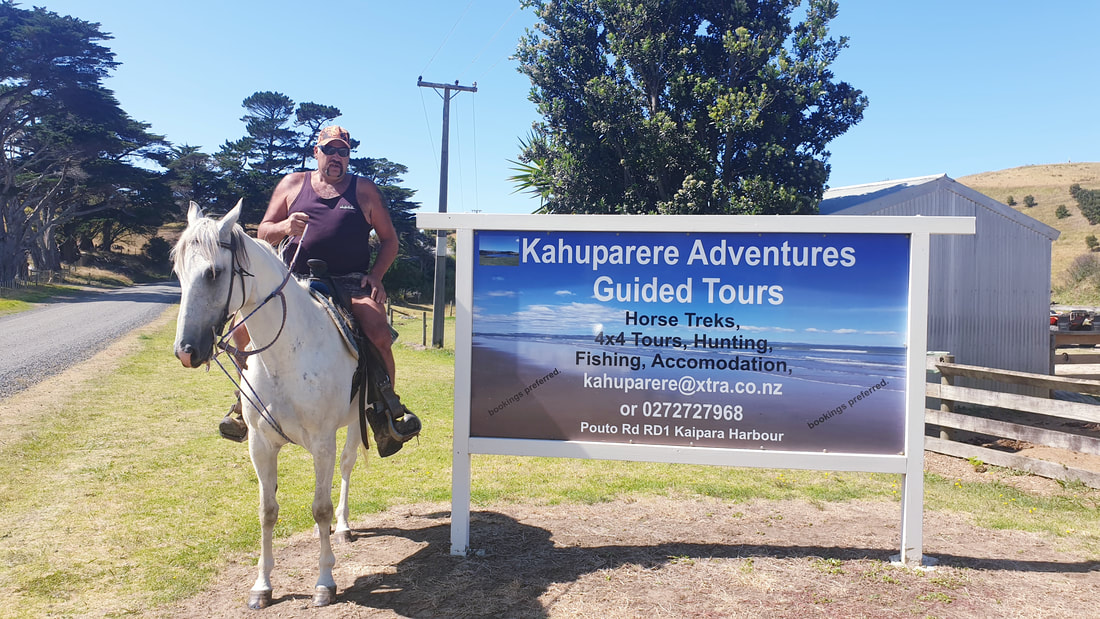
Kahuparere Adventures
4x4 Pouto Lighthouse Safari Tour
A 6 seater 4x4 Polaris ADVENTURE past Lake Kahuparere, Pouto Forest, sand dunes, to the entrance point of Ripiro beach & access into NZ's oldest Kauri Lighthouse.
Horse Treks
Bring your own horse or rent one of our lovely trekking horses with a guided ADVENTURE tour. There are numerous treks available for riders of all abilities.
Hunting & Fishing
Pouto is World famous for its hunting & Fishing. Steve can guide you to some of the most intrepid hunting & fishing ADVENTURE in the Kaipara.
Accommodation
Looking for accommodation to mix or match with your Kahuparere Adventure, talk to Steve about this too.
Contact person: Steven Nathan | Mobile: 027 272 7968 | Email: kahuparere@xtra.co.nz | Address: Pouto Road, Pouto Peninsula
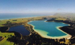
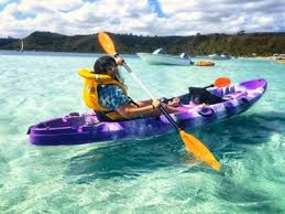
Kai Iwi Lakes
Kai Iwi Lakes is a great family aquatic get away. There are two camp grounds within the Taharoa Domain and plenty other options close by. Activities you can partake in are fishing, water skiing, sailing, canoing, swimming, walking waka ama, jet skis, and cycling.
Address: Kai Iwi Lakes Road, Omamari
Kai Iwi Lakes Camp Ground
Perfect for a wonderful camping experience with the choice of two camp grounds located on the lake foreshore, both offering an ideal camping experience for tents, caravans or motorhomes.
Pine Beach Campsites, wash and shower facilities, two flushing toilet blocks, and playground. In the summer there are seasonal services including a mobile shop, and camp staff are on site. A limited number of powered sites must be booked as per the other sites at the camp ground.
Promenade Point A truly relaxed kiwiana camping experience: camping areas, new toilet block. No shower facilities.
No Pets Because we want to protect our native wildlife, we have a strict no-pets policy. We hope you’ll understand
Contact person: KDC/DOC | Phone: (09) 439 0986 | Email: lakes@kaipara.govt.nz | Address: Kai Iwi Lakes Rd
Kai Iwi Lakes Track
Description: This easy and enjoyable track begins at Kai Iwi Lakes Road and heads over farmland to the expansive Ripiro Beach (30 minutes). Return back along the same track or continue north along Ripiro Beach to the other end at Aranga Beach Road (a further 1 hour 30 minutes). The view to the north is dominated by the majestic Maunganui Bluff in the distance, and marks the end of this track.
Getting there: Access is from Kai Iwi Lakes Road. From Dargaville, head north on SH12 for 23.6 km. Turn left onto Omamari Road and follow this for 7.6 km, then turn right into Kai Iwi Lakes Road and follow this for 4.8 km. The start of the track is signposted on the left of the road. To walk the track in reverse, start on the northern end on Aranga Beach Road. From Dargaville, head north on SH12 for 36 km, then turn left onto Aranga Beach Road and continue for 6.5 km to the road end.
Know before you go: Access along the coastline is limited to the intertidal zone – the land above high tide is private land and trespassers may be prosecuted.
Contact person: Department of Conservation | Address: Kai Iwi Lakes to Maunganui Bluff | Schedule: Activity Level: Medium to High
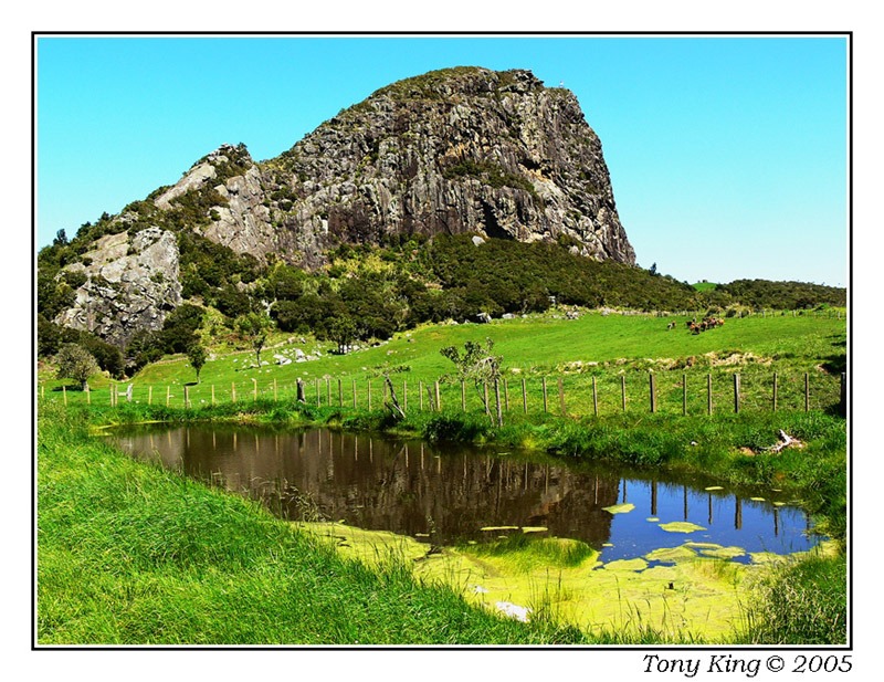
Maungaraho Rock
This interesting feature on the landscape is a huge rocky outcrop rising from the countryside not far from Tokatoka. There are 2 tracks, the lower track circles the base of this bushclad rocky bluff and the other leads off this one to the top. It is a 45 minute walk around the base, while the track to the summit takes 30 minutes. The track to the summit requires fitness as it is steep and entails some climbing. In places ropes and ladders assist this.
Located on Mititai Road, Arapohue, off State Highway 12, 11 kms south of Dargaville.
Contact person: KDC/DOC | Schedule: Activity Level: Medium to High
Taha Awa Riverside Gardens
This community garden has been created for the enjoyment of locals and visitors to Dargaville. It includes a childrens playground, fernery building, sensual garden and meandering paths. Great place for a picnic, catching up with friends and family or just a quiet stroll.
Address: Totara Street, Dargaville | Schedule: Activity Level: Low
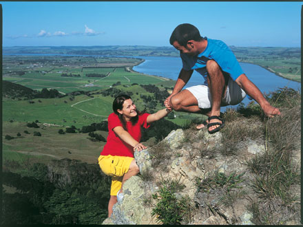
Tokatoka Peak
From the top, the 360-degree views are stunning. You'll get great views towards Dargaville and of the Kaipara. On a clear day, you're able to see Bream Head and the Tangihua range towards the east.
The track climbs steadily to the top of Tokatoka, a very distinctive landmark in the Kaipara district. Note, there is a particularly steep 20 m section near the top.
Getting there: The turn off to this reserve is on Tokotoka Road, 17 km south of Dargaville on SH 12 at the Tokatoka Tavern. The reserve entrance sign is on your left-hand side near the top of the hill.
Know before you go:
- This is a very exposed area; with a steep ascent over rocks.
- Take extreme caution at the top as the drop off is steep and there are no handrails, especially if you suffer from vertigo or are scared of heights.
- Supervise children at all times.
- The track becomes very slippery after rain. Take extreme care.
- Degree of Difficulty - high and not for the faint hearted.
Contact person: KDC/DOC | Address: Tokatoka Rd, off SH12, 17kms south of Dargaville | Schedule: Activity Level Medium to High
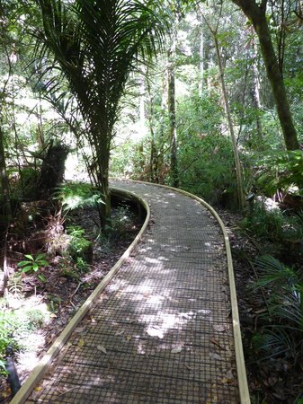
Trounson Park
Trounson Kauri Park is a mainland island. The restoration project includes a 586-hectare forest reserve and farmland. The project aims to restore the former richness of native biodiversity this forest once boasted, and to let visitors enjoy a glimpse of what pristine kauri forests were once like. It is home to several threatened species, such as North Island brown kiwi, kūkupa (New Zealand pigeon), pekapeka (bats) and kauri snails. It also incorporates a magnificent dense stand of kauri that has long been recognised as one of the best examples in the country.
Getting there: Trounson Kauri Park is located in western Northland, 40 km north of Dargaville. Follow State Highway 12 towards the Waipoua Forest. After the Kaihu township, turn right onto Trounson Park Road. The main entrance to the Trounson Kauri Park is just past the corner from Mangatu Road.
Know before you go: Wasps - There are high numbers of wasps particularly between January and April. Consider carrying an antihistamine product and if you are allergic to their stings ensure you take your medication.
Contact person: Department of Conservation | Phone: 09 439 3450 | Email: dargaville@doc.govt.nz | Address: Trounson Park Rd, Kaihu | Schedule: Activity Level: Low to Medium
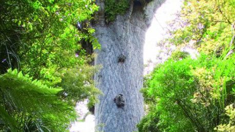
Waipoua Forest
Waipoua, and the adjoining forests of Mataraua and Waima, make up the largest remaining tract of native forest in Northland. Most of Northland’s ancient forest cover has been lost to saw and fire, plundered for the precious timber of the kauri tree or cleared for farmland. However the forests are now under the protection of the Department of Conservation.
Waipoua is home to the kauri, one of the world’s mightiest trees. The largest kauri reach more than 50 metres tall, have trunk girths up to 16 metres, and sprang from seed as long as 2,000 years ago.
Watch the Footprints Waipoua video to learn about the significance of kauri trees in Waipoua.
The endangered North Island kokako and the North Island brown kiwi both live here.
Getting there: Waipoua Forest can be found on State Highway 12, 45 km north of Dargaville on Northland's west coast between Dargaville and Omapere.
Know before you go:
- No domestic pets are allowed.
- There is no general store, petrol station or supermarket in Waipoua Forest.
- Nearest petrol station is 28 km south at Kaihu, and 20 km north at Waimamaku.
- Nearest toilets are located at the Tane Mahuta Carpark or the Waipoua Visitor Centre.
Wasps - There are high numbers of wasps particularly between January and April. Consider carrying an antihistamine product and if you are allergic to their stings ensure you take your medication.
Address: State Highway 12 | Schedule: Activity Level: Low to Medium